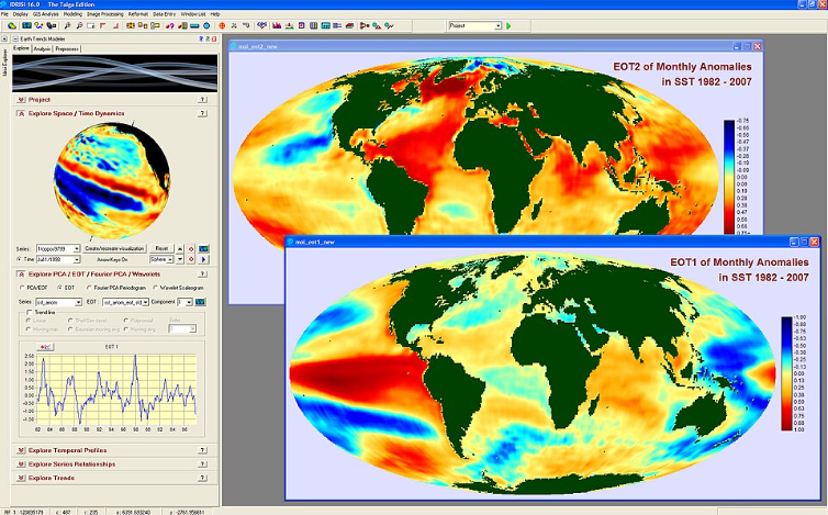
Smart mapping is becoming mainstream in focusing on environmental compliance. To get approval from the regulatory authorities for construction projects and to assess the risks associated with the soil, it is important to use smart mapping options. Here are some of the essential smart mapping tools to assess environmental compliance for construction or infrastructural projects.
- GIS (Geographic Information System)
- GPS (Global Positioning System)
Remote Sensing
Spatial Monitoring and Reporting Tool (SMART)
The smart mapping tools are great for assessing the environmental monitoring of environmental projects. As per the impact of the mapping tools, the environmental projects are assessed not only by fundamental mapping but also through effective data management. Here is what smart mapping means and why it matters in environmental project management.
What Is Smart Mapping?
In simple terms, smart mapping helps to create visual representations of local data in geographical areas. Here are some of the key tools that offer smart mapping visualization:
|
Mapping Tools |
How They Are Used |
|
GIS (Geographic Information System) |
GIS is best used in analyzing spatial insights and the visualization of maps. These tools also help in analyzing different types of data used in urban planning, identifying the contaminated lands, and assessing the air and water quality changes. |
|
GPS (Global Positioning System) |
Helps in providing accurate data on location. Using GPS-enabled devices, the air and water movements can be analyzed. |
|
Remote Sensing |
Remote sensing is largely used in environmental monitoring as it is able to detect land use and land cover. Mainly obtaining data from satellite, remote sensing technology is a key tool in managing water resource and vegetation growth. |
|
Spatial Monitoring and Reporting Tool (SMART) |
This is a software that collects data and makes informed decisions. It helps in monitoring a protected area. Furthermore, it also enables user to allocate resources relying on the data gathered. |
Different Types of SMART Mapping Tool
Smart Mapping in Environmental Monitoring
In different kinds of environmental project management, smart mapping tools are used for effective monitoring and tracking changes in natural resources.
Tracking Air and Water Quality Changes
Environmental conservationists use GIS technology and 3D scanning to highlight the potential areas with air and water quality changes. The data-driven, evidence-backed insights obtained from GIS helps in environmental protection.
Mapping Soil Contamination
Using smart mapping technologies like remote sensing and GIS, the properties of soil can be analyzed. On top of that, GIS can be used in processes like digital soil mapping (DSM) which can analyze soil information using statistical methods and environmental data.
Applications in Construction and Infrastructure Projects
Smart mapping tools like GIS are revolutionizing construction projects by helping them choose the right type of terrain. Here is how these technologies are being used in construction projects:
Mapping Protected Zones and Buffer Areas
GIS and other smart mapping tools can effectively map protected and buffer areas where construction projects cannot be initiated. Moreover, it helps in site selection by 3D Scanning and interactive maps. Therefore, contractors can understand the project site better.
Monitoring Environmental Disturbances During Site Development
GIS helps in assessing potential hazards and risks associated with the construction project.
Improved Decision-Making and Reporting
As of now, the essential aspects of smart mapping tools have been discussed. But how can smart mapping help in making improved decisions? Let’s find out.
Automated Compliance Reports
Using spatial data, tools like GIS and remote sensing can automate the compliance report, highlighting key environmental factors and data.
Predictive Modelling
GIS tools also use predictive modeling, which results in finding spatial relationships between environmental phenomena. It can also predict the impact of impending natural disasters and focus on climate changes on the ecosystems.
Use of Remote Sensors
Remote sensing refers to the process of identifying and monitoring the external characteristics. This is how remote sensors work in identifying different areas.
High-resolution Aerial Imagery
Remote sensor cameras are placed on satellites, which helps in covering a larger area. Therefore, it can track the environmental changes of a particular area. While considering environmental project management, this smart mapping tool can be very effective in tracking natural phenomena like forest fires and the movement of clouds.
Real-time Vegetation and Land Use Monitoring
Remote sensing can also be used in tracking the change of vegetation and farmland over time. Plus, it also helps in mapping the land use.
Wrapping Up
Smart mapping tools are changing the approach to environmental compliance. These tools are effective in offering precise monitoring, improved decision making and focusing on providing key insight that
helps in environmental conservation.
Explore New Smart Mapping Options for Environmental Regulatory Reporting!
Want to follow the environmental compliance? Explore smart mapping options for developing the safety of your project and providing standard regulatory reporting.


